Nestled along the serene Atlantic coastline, Coastal North Carolina boasts sun-kissed beaches and charming communities that embody the essence of coastal living. Yet, beneath the postcard-perfect exterior, a silent, ever-present menace lurks – the perpetual risk of flooding. In this article, we delve into the intricate landscape of flood risk in Coastal North Carolina, shedding light on the critical need to comprehend, mitigate, and manage the potential for inundation in this idyllic but vulnerable region.
This slice of paradise holds within its embrace a paradox, where the allure of coastal living is intertwined with the challenge of flood-prone landscapes. Understanding the multifaceted nature of this risk is not just a choice but a necessity for both residents and visitors, for it equips us to protect our homes, preserve our communities, and embrace the unique essence of Coastal North Carolina.
The Geography of Coastal North Carolina
 Image Source: Anchor
Coastal North Carolina, often known as the “Crystal Coast,” graces the Atlantic coastline with its pristine beaches and picturesque communities. This region, a haven for coastal living enthusiasts, boasts stunning landscapes, including maritime forests and barrier islands, creating a lasting impression on those who visit or call it home.
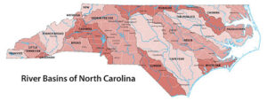
Beneath the region’s beauty lies a geographical challenge. Coastal North Carolina’s susceptibility to flooding is rooted in its low-lying geography. Most of the area sits near sea level, making it vulnerable to various flood scenarios. Its coastal position exposes it to hurricane-related flooding, characterized by storm surges, high tides, and heavy rainfall. Inland, a complex network of rivers and creeks further exacerbates the flooding risk, especially during severe weather events.
A glance at the past reveals a long history of grappling with flooding in this region. Coastal North Carolina has weathered hurricanes, nor’easters, and tropical storms, each leaving its mark in the form of submerged streets and resilient communities. These historical flood events underscore the ongoing need for proactive flood risk management, whether through improved infrastructure, stricter building codes, or informed community planning.
Flood Risk Factors
The meteorological intricacies of Coastal North Carolina make it particularly vulnerable to flooding, particularly during hurricane season. As these powerful tropical storms develop, a complex interplay of weather patterns, warm ocean waters, and atmospheric conditions can result in heavy rainfall, intensifying flooding risks.
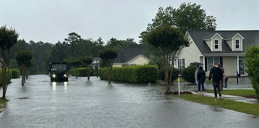
Coastal areas face immediate and severe threats from storm surges during hurricanes and severe weather events. These surges and high tides lead to rapid sea level rises, causing widespread coastal inundation and considerable damage.
Further inland rivers and creeks pose additional flood risks. Prolonged periods of rainfall, particularly during or after storms, can cause these waterways to overflow their banks, affecting communities beyond the immediate coast.
The ongoing challenge of climate change exacerbates flood risk in Coastal North Carolina. Rising sea levels and shifting weather patterns, driven by global climate change, demand adaptive measures to confront the increasing threats to lives and property.
FEMA Flood Maps
 Image Source: FEMA
FEMA, the Federal Emergency Management Agency, is at the forefront of flood mapping, which is essential for understanding and mitigating flood risks in Coastal North Carolina. They meticulously gather data from various sources, analyze it, and create flood hazard maps. These maps highlight areas prone to flooding, enabling residents and local authorities to develop flood risk management strategies.
Accessing FEMA flood maps is easy and crucial for flood risk awareness. They can be obtained through FEMA’s website, local government offices, or regional FEMA offices. These maps empower individuals, property buyers, and community planners to make informed decisions.
Interpreting FEMA flood maps involves understanding Special Flood Hazard Areas (SFHAs) and Base Flood Elevations (BFEs). SFHAs mark high flood risk zones, while BFEs indicate expected water levels during base floods. Knowing how to read these maps helps assess flood risk, insurance needs, and compliance with local regulations, contributing to effective flood mitigation and resilience.
Understanding Your Risk
Assessing your property’s location in relation to flood zones is the first crucial step in understanding flood risk. FEMA flood maps can help identify if your property falls within Special Flood Hazard Areas (SFHAs), indicating a high flood risk. This information is pivotal for property investment, insurance decisions, and preparedness.
Elevation, especially the Base Flood Elevation (BFE), is vital for assessing flood risk. If your property’s lowest floor is below the BFE, it’s at higher risk of flooding. Understanding this data allows you to take measures like elevating your property or securing flood insurance to mitigate potential losses.
Local floodplain management regulations and building codes are essential for safety and resilience. Compliance with these regulations is a legal requirement and a means to minimize flood risks through construction and retrofitting standards. Adhering to these rules can influence property values, insurance costs, and access to financial assistance in times of disaster. Engaging with local officials guides compliance and enhances community safety.
Flood Insurance
 Image Source: tirachardz on Freepik
Flood insurance is a lifeline in Coastal North Carolina, where the risk of flooding from hurricanes, storm surges, and river overflow is ever-present. Standard homeowners’ insurance does not cover flood damage, making flood insurance indispensable. Without it, residents may face significant financial burdens in the event of a flood, including property repairs, replacing belongings, and temporary housing.
The National Flood Insurance Program (NFIP), administered by FEMA, is the region’s primary source of flood insurance. It provides coverage for property owners, renters, and businesses. Beyond individual protection, NFIP also supports communities in managing flood risk and enforcing building regulations.
Securing flood insurance in Coastal North Carolina is a straightforward process through an insurance agent. Policies’ costs depend on factors like property location and chosen coverage limits. It’s essential to act early, as there’s typically a 30-day waiting period before the policy takes effect. Investing in flood insurance is a small price to pay for financial peace of mind in a region prone to flooding.
Evacuation and Emergency Preparedness
Evacuation plans are pivotal in Coastal North Carolina’s flood risk management. These structured plans, devised by local emergency management agencies, guide residents to safety during flood events. They include evacuation routes, shelter locations, and timing to ensure a swift and organized response to impending flood threats.
An essential component of flood preparedness is creating an emergency kit. These kits should contain non-perishable food, water, clothing, first-aid supplies, medications, flashlights, batteries, and important documents. A communication plan is vital, ensuring you can stay connected with family and emergency services. Building an emergency kit well in advance of potential flood events is crucial for ensuring access to essential supplies.
Staying informed during a flood event is vital. Residents should closely monitor weather forecasts and advisories from the National Weather Service and local emergency management agencies. Information can be accessed through various platforms, including TV, radio, social media, weather apps, and emergency alert systems. Being well-informed allows for timely decision-making, facilitates communication with loved ones, and ensures access to vital assistance during flood events.
Future Challenges and Climate Change
 Image Source: Freepik
Climate change poses mounting challenges for Coastal North Carolina. Rising sea levels, driven by global warming, heighten the risk of flooding and erosion in this low-lying region. Additionally, warming ocean waters lead to more intense hurricanes, increasing the threat of devastating storm surges and heavy rainfall during hurricane seasons.
To address these challenges, adaptive measures are crucial. Investments in resilient infrastructure, updated zoning and building codes, and nature-based solutions like wetland restoration are essential. Collaborative community planning, reduced greenhouse gas emissions, and conservation efforts all play a part in building climate resilience. Coastal North Carolina must adapt and evolve to thrive in the face of changing climate conditions.
Wrapping Up
Coastal North Carolina’s allure and flood risk are intertwined. This article has stressed the significance of understanding and managing flood risk, encouraging readers to take proactive measures. Community involvement is key in building resilience against flooding and climate change. Living in this region is a cherished experience, but it comes with the responsibility of safeguarding it for the future. Together, we can preserve Coastal North Carolina’s unique way of life while protecting our homes and communities.


Leave a Reply