FEMA Approves More Than $11 Million in Federal Funding for the Kentucky Division of Emergency Management FRANKFORT, Ky. – FEMA has approved more than $11 million for the Kentucky Division of Emergency Management (KYEM) for debris removal operations undertaken to remove debris deposited throughout Kentucky by last summer’s severe storms, flooding, landslides and mudslides. Following the devastating flood event, debris removal,...
Storm News:
Capturing Incredible Tornadoes LIVE: The Key to Saving Lives
The Deadly Obsession: The Real Culprit Behind Tornado Deaths
Reflecting on the Tragic Tornado Day: A Meteorologist’s Perspective
Revolutionary Weather Service Transformation: Slashes False Tornado Warnings
The Challenges of Tornadoes and Rural Support: A Personal Reflection
Unbelievable Flooding in Greensboro Revolution Mill Overwhelmed by Powerful Waters
Recapping Tuesday’s storm and forecasting Friday’s severe weather threat [Ep. 476]
SPC Tornado Watch: Alabama, Florida, Georgia
SPC Severe Thunderstorm Watch: West and Southwest Texas
Coping With Holiday Stress After a Disaster
SPC Tornado Watch: North Carolina
SPC Tornado Watch: North Carolina
Be Alert to Fraud After a Disaster
How to Apply for FEMA Assistance After Severe Storms
FEMA Working Through the Holiday Season for Hurricane Idalia Survivors
Tornado warning for Halifax, Warren, Franklin counties in North Carolina
SPC Tornado Watch: North Carolina, Virginia
Tornado warning for Raleigh, North Carolina
SPC Tornado Watch: Florida
Category: National Weather
FEMA Approves More Than $11 Million in Federal Funding for the Kentucky Division of Emergency Management
Fantasy football weather forecast: How to prepare for your game day
#nfl #football #weather #fantasy #fantasyfootball Considering the impacts of weather on an NFL football game can give you a real advantage in fantasy football. The Fantasy Football Weather Guys help you understand what could impact next week’s games and how players historically perform during certain weather conditions, such as wind, snow, and rain. This week...
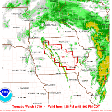
SPC Tornado Watch: Iowa
Note:
The expiration time in the watch graphic is amended if the watch is
replaced, cancelled or extended.Note: Click for Watch Status Reports.
SEL0
URGENT - IMMEDIATE BROADCAST REQUESTED
Tornado Watch Number 710
NWS Storm Prediction Center Norman OK
125 PM CDT Fri Oct 13 2023
The NWS Storm Prediction Center has issued a
* Tornado Watch for portions of
Central into southeast Iowa
* Effective this Friday afternoon and evening from 125 PM until
800 PM CDT.
* Primary threats include...
A few tornadoes possible
Isolated damaging wind gusts to 60 mph possible
Isolated large hail events to 1 inch in diameter possible
SUMMARY...Scattered low-topped thunderstorms will form this
afternoon along a slow-moving front across central Iowa. The storm
environment will favor of mix of multicells and some supercells
capable of producing a few tornadoes, along with isolated marginally
severe hail and wind gusts.
The tornado watch area is approximately along and 35 statute miles
north and south of a line from 35 miles west northwest of Fort Dodge
IA to 30 miles south of Cedar Rapids IA. For a complete depiction of
the watch see the associated watch outline update (WOUS64 KWNS
WOU0).
PRECAUTIONARY/PREPAREDNESS ACTIONS...
REMEMBER...A Tornado Watch means conditions are favorable for
tornadoes and severe thunderstorms in and close to the watch
area. Persons in these areas should be on the lookout for
threatening weather conditions and listen for later statements
and possible warnings.
&&
AVIATION...Tornadoes and a few severe thunderstorms with hail
surface and aloft to 1 inch. Extreme turbulence and surface wind
gusts to 50 knots. A few cumulonimbi with maximum tops to 350. Mean
storm motion vector 18020.
...Thompson
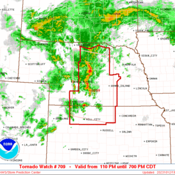
SPC Tornado Watch: Kansas/Nebraska
Note:
The expiration time in the watch graphic is amended if the watch is
replaced, cancelled or extended.Note: Click for Watch Status Reports.
SEL9
URGENT - IMMEDIATE BROADCAST REQUESTED
Tornado Watch Number 709
NWS Storm Prediction Center Norman OK
110 PM CDT Thu Oct 12 2023
The NWS Storm Prediction Center has issued a
* Tornado Watch for portions of
Northern Kansas
Central Nebraska
* Effective this Thursday afternoon and evening from 110 PM until
700 PM CDT.
* Primary threats include...
A few tornadoes possible
Scattered large hail likely with isolated very large hail events
to 2 inches in diameter possible
Isolated damaging wind gusts to 65 mph possible
SUMMARY...Scattered strong to severe thunderstorms are expected to
continue to develop across central Nebraska into northern Kansas
this afternoon, including some supercells capable of tornadoes and
large hail.
The tornado watch area is approximately along and 110 statute miles
north and south of a line from 55 miles west southwest of Broken Bow
NE to 20 miles southeast of Grand Island NE. For a complete
depiction of the watch see the associated watch outline update
(WOUS64 KWNS WOU9).
PRECAUTIONARY/PREPAREDNESS ACTIONS...
REMEMBER...A Tornado Watch means conditions are favorable for
tornadoes and severe thunderstorms in and close to the watch
area. Persons in these areas should be on the lookout for
threatening weather conditions and listen for later statements
and possible warnings.
&&
OTHER WATCH INFORMATION...CONTINUE...WW 708...
AVIATION...Tornadoes and a few severe thunderstorms with hail
surface and aloft to 2 inches. Extreme turbulence and surface wind
gusts to 55 knots. A few cumulonimbi with maximum tops to 450. Mean
storm motion vector 21030.
...Guyer
SPC Tornado Watch: Florida Status Reports
Watch 708 Status Reports STATUS REPORT #1 ON WW 708 VALID 121315Z - 121500Z THE SEVERE WEATHER THREAT CONTINUES ACROSS THE ENTIRE WATCH AREA. FOR ADDITIONAL INFORMATION SEE MESOSCALE DISCUSSION 2244 ..SMITH..10/12/23 ATTN...WFO...JAX...TBW...TAE...MLB... && STATUS REPORT FOR WT 708 SEVERE WEATHER THREAT CONTINUES FOR THE FOLLOWING AREAS FLC001-003-007-017-019-023-029-031-035-041-053-057-067-069-075- 081-083-095-101-103-107-109-117-119-121-123-125-127-121500- FL . FLORIDA COUNTIES INCLUDED ARE...
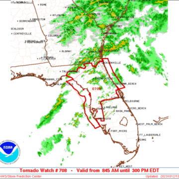
SPC Tornado Watch: Florida
Note:
The expiration time in the watch graphic is amended if the watch is
replaced, cancelled or extended.Note: Click for Watch Status Reports.
SEL8
URGENT - IMMEDIATE BROADCAST REQUESTED
Tornado Watch Number 708
NWS Storm Prediction Center Norman OK
845 AM EDT Thu Oct 12 2023
The NWS Storm Prediction Center has issued a
* Tornado Watch for portions of
Northern and central Florida
Coastal Waters
* Effective this Thursday morning and afternoon from 845 AM until
300 PM EDT.
* Primary threats include...
A few tornadoes possible
Isolated damaging wind gusts to 70 mph possible
SUMMARY...Some supercell/tornado potential should persist through at
least midday across northern and portions of central FL, as
destabilization counterbalances very slowly weakening shear. A few
damaging to severe gusts also may occur from the most vigorous
cells.
The tornado watch area is approximately along and 70 statute miles
either side of a line from 60 miles east northeast of Saint
Petersburg FL to 40 miles north northeast of Cross City FL. For a
complete depiction of the watch see the associated watch outline
update (WOUS64 KWNS WOU8).
PRECAUTIONARY/PREPAREDNESS ACTIONS...
REMEMBER...A Tornado Watch means conditions are favorable for
tornadoes and severe thunderstorms in and close to the watch
area. Persons in these areas should be on the lookout for
threatening weather conditions and listen for later statements
and possible warnings.
&&
OTHER WATCH INFORMATION...This tornado watch replaces tornado
watch number 707. Watch number 707 will not be in effect after
845 AM EDT.
AVIATION...Tornadoes and a few severe thunderstorms with hail
surface and aloft to 1 inch. Extreme turbulence and surface wind
gusts to 60 knots. A few cumulonimbi with maximum tops to 550. Mean
storm motion vector 23030.
...Edwards
SPC Tornado Watch Status Reports: Florida
Watch 707 Status Reports STATUS REPORT #1 ON WW 707 VALID 120535Z - 120640Z THE SEVERE WEATHER THREAT CONTINUES ACROSS THE ENTIRE WATCH AREA. ..BROYLES..10/12/23 ATTN...WFO...JAX...TBW...TAE...MLB... && STATUS REPORT FOR WT 707 SEVERE WEATHER THREAT CONTINUES FOR THE FOLLOWING AREAS FLC001-007-017-019-023-029-035-037-041-045-049-053-057-067-069- 075-081-083-095-097-101-103-105-107-109-115-117-119-121-123-125- 127-129-120640- FL . FLORIDA COUNTIES INCLUDED ARE ALACHUA BRADFORD CITRUS CLAY COLUMBIA DIXIE...
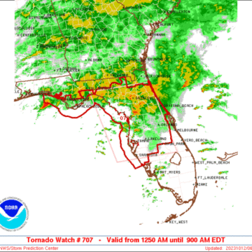
SPC Tornado Watch: Florida
Note:
The expiration time in the watch graphic is amended if the watch is
replaced, cancelled or extended.Note: Click for Watch Status Reports.
SEL7
URGENT - IMMEDIATE BROADCAST REQUESTED
Tornado Watch Number 707
NWS Storm Prediction Center Norman OK
1250 AM EDT Thu Oct 12 2023
The NWS Storm Prediction Center has issued a
* Tornado Watch for portions of
Northern and Central Florida
Coastal Waters
* Effective this Thursday morning from 1250 AM until 900 AM EDT.
* Primary threats include...
A couple tornadoes possible
Isolated damaging wind gusts to 65 mph possible
SUMMARY...Stronger thunderstorms are expected to develop and/or move
inland across the central and northern Peninsula through the early
morning hours as conditions become increasingly favorable for the
possibility of tornadoes.
The tornado watch area is approximately along and 85 statute miles
east and west of a line from 45 miles north northeast of Cross City
FL to 30 miles east southeast of Sarasota FL. For a complete
depiction of the watch see the associated watch outline update
(WOUS64 KWNS WOU7).
PRECAUTIONARY/PREPAREDNESS ACTIONS...
REMEMBER...A Tornado Watch means conditions are favorable for
tornadoes and severe thunderstorms in and close to the watch
area. Persons in these areas should be on the lookout for
threatening weather conditions and listen for later statements
and possible warnings.
&&
AVIATION...Tornadoes and a few severe thunderstorms with hail
surface and aloft to 0.5 inches. Extreme turbulence and surface wind
gusts to 55 knots. A few cumulonimbi with maximum tops to 500. Mean
storm motion vector 24030.
...Guyer
FEMA Teams in Field to Help Idalia Survivors
FEMA Teams in Field to Help Idalia Survivors LAKE MARY, Fla. – FEMA Disaster Survivor Assistance (DSA) specialists are working in communities affected by Hurricane Idalia, helping people apply for federal assistance and referring them to additional resources for their recovery. These specialists carry FEMA identification and never charge for service. More than 126 specialists...
Hurricane Disaster Recovery Center Opens in Brooks County
Hurricane Disaster Recovery Center Opens in Brooks County ATLANTA – The State of Georgia and FEMA have opened a Disaster Recovery Center (DRC) in Brooks County to serve Hurricane Idalia survivors from Berrien, Brooks, Cook, Glynn and Lowndes counties. DRCs are dedicated, accessible and established locations where specialists from FEMA’s Individual Assistance program can help...


