WW 696 SEVERE TSTM NM TX 021900Z – 030200Z URGENT - IMMEDIATE BROADCAST REQUESTED Severe Thunderstorm Watch Number 696 NWS Storm Prediction Center Norman OK 200 PM CDT Mon Oct 2 2023 The NWS Storm Prediction Center has issued a * Severe Thunderstorm Watch for portions of Eastern New Mexico Southwest Texas * Effective this...
Storm News:
Capturing Incredible Tornadoes LIVE: The Key to Saving Lives
The Deadly Obsession: The Real Culprit Behind Tornado Deaths
Reflecting on the Tragic Tornado Day: A Meteorologist’s Perspective
Revolutionary Weather Service Transformation: Slashes False Tornado Warnings
The Challenges of Tornadoes and Rural Support: A Personal Reflection
Unbelievable Flooding in Greensboro Revolution Mill Overwhelmed by Powerful Waters
Recapping Tuesday’s storm and forecasting Friday’s severe weather threat [Ep. 476]
SPC Tornado Watch: Alabama, Florida, Georgia
SPC Severe Thunderstorm Watch: West and Southwest Texas
Coping With Holiday Stress After a Disaster
SPC Tornado Watch: North Carolina
SPC Tornado Watch: North Carolina
Be Alert to Fraud After a Disaster
How to Apply for FEMA Assistance After Severe Storms
FEMA Working Through the Holiday Season for Hurricane Idalia Survivors
Tornado warning for Halifax, Warren, Franklin counties in North Carolina
SPC Tornado Watch: North Carolina, Virginia
Tornado warning for Raleigh, North Carolina
SPC Tornado Watch: Florida
Category: National Weather
Severe Thunderstorm Watch: Texas
WW 695 SEVERE TSTM TX 242150Z – 250400Z URGENT - IMMEDIATE BROADCAST REQUESTED Severe Thunderstorm Watch Number 695 NWS Storm Prediction Center Norman OK 450 PM CDT Sun Sep 24 2023 The NWS Storm Prediction Center has issued a * Severe Thunderstorm Watch for portions of North and central Texas * Effective this Sunday afternoon...
Severe Thunderstorm Watch: Arkansas, Oklahoma, Texas
WW 694 SEVERE TSTM AR OK TX 240310Z – 241100Z URGENT - IMMEDIATE BROADCAST REQUESTED Severe Thunderstorm Watch Number 694 NWS Storm Prediction Center Norman OK 1010 PM CDT Sat Sep 23 2023 The NWS Storm Prediction Center has issued a * Severe Thunderstorm Watch for portions of Western Arkansas Eastern Oklahoma Extreme northeast Texas...
Severe Thunderstorm Watch: Kansas, Missouri
WW 693 SEVERE TSTM KS MO 232235Z – 240500Z URGENT - IMMEDIATE BROADCAST REQUESTED Severe Thunderstorm Watch Number 693 NWS Storm Prediction Center Norman OK 535 PM CDT Sat Sep 23 2023 The NWS Storm Prediction Center has issued a * Severe Thunderstorm Watch for portions of Southeast Kansas Southwest Missouri * Effective this Saturday...
Severe Thunderstorm Watch: Oklahoma
WW 692 SEVERE TSTM OK 232105Z – 240400Z URGENT - IMMEDIATE BROADCAST REQUESTED Severe Thunderstorm Watch Number 692 NWS Storm Prediction Center Norman OK 405 PM CDT Sat Sep 23 2023 The NWS Storm Prediction Center has issued a * Severe Thunderstorm Watch for portions of Central and Eastern Oklahoma * Effective this Saturday afternoon...
Severe Thunderstorm Watch Status Reports: Kansas, Missouri
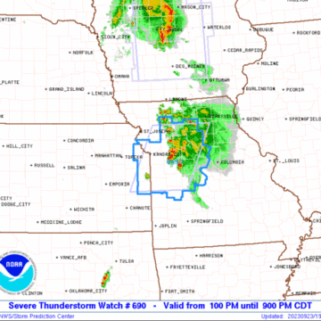
WW 0690 Status Updates STATUS REPORT ON WW 690 THE SEVERE WEATHER THREAT CONTINUES ACROSS THE ENTIRE WATCH AREA. ..SUPINIE..09/23/23 ATTN...WFO...EAX...SGF... STATUS REPORT FOR WS 690 SEVERE WEATHER THREAT CONTINUES FOR THE FOLLOWING AREAS KSC091-103-107-121-209-232040- KS . KANSAS COUNTIES INCLUDED ARE JOHNSON LEAVENWORTH LINN MIAMI WYANDOTTE MOC013-015-025-033-037-041-047-053-061-083-089-095-101-107-115- 117-141-159-165-177-185-195-232040- MO . MISSOURI COUNTIES INCLUDED ARE BATES...
Severe Thunderstorm Watch Status Reports: Iowa
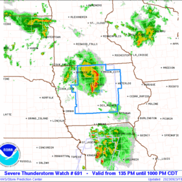
WW 0691 Status Updates STATUS REPORT ON WW 691 THE SEVERE WEATHER THREAT CONTINUES ACROSS THE ENTIRE WATCH AREA. ..SUPINIE..09/23/23 ATTN...WFO...DMX...ARX... STATUS REPORT FOR WS 691 SEVERE WEATHER THREAT CONTINUES FOR THE FOLLOWING AREAS IAC001-009-013-015-017-023-025-027-029-033-037-049-063-067-069- 073-075-077-079-081-083-091-099-109-121-123-125-127-147-151-153- 157-161-169-171-181-187-189-195-197-232040- IA . IOWA COUNTIES INCLUDED ARE ADAIR AUDUBON BLACK HAWK BOONE BREMER BUTLER CALHOUN CARROLL CASS CERRO GORDO...
Severe Thunderstorm Watch: Nebraska, South Dakota, Wyoming
WW 689 SEVERE TSTM NE SD WY 221935Z – 230300Z URGENT - IMMEDIATE BROADCAST REQUESTED Severe Thunderstorm Watch Number 689 NWS Storm Prediction Center Norman OK 135 PM MDT Fri Sep 22 2023 The NWS Storm Prediction Center has issued a * Severe Thunderstorm Watch for portions of Western Nebraska Southwest South Dakota Eastern Wyoming...
Tornado Watch Status Reports: Kansas, Nebraska
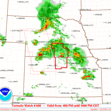
WW 0688 Status Updates STATUS REPORT ON WW 688 THE SEVERE WEATHER THREAT CONTINUES ACROSS THE ENTIRE WATCH AREA. ..LYONS..09/21/23 ATTN...WFO...GID... STATUS REPORT FOR WT 688 SEVERE WEATHER THREAT CONTINUES FOR THE FOLLOWING AREAS KSC089-123-141-183-220040- KS . KANSAS COUNTIES INCLUDED ARE JEWELL MITCHELL OSBORNE SMITH NEC001-019-035-061-079-099-129-181-220040- NE . NEBRASKA COUNTIES INCLUDED ARE ADAMS BUFFALO CLAY...
Tornado Watch: Kansas, Nebraska
WW 688 TORNADO KS NE 212150Z – 220300Z URGENT - IMMEDIATE BROADCAST REQUESTED Tornado Watch Number 688 NWS Storm Prediction Center Norman OK 450 PM CDT Thu Sep 21 2023 The NWS Storm Prediction Center has issued a * Tornado Watch for portions of North central Kansas South central Nebraska * Effective this Thursday afternoon...


